穆尔豪斯,世纪的见证者
从凯尔特摇篮到现代都市:一座永不停息的城市
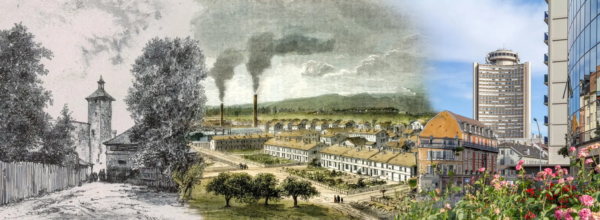
探索穆尔豪斯引人入胜的历史,从公元前1000年的凯尔特起源,穿越时代,直到其作为工业重镇的角色和2024年最新的生态转型。每个时代都留下了持久的印记。如今,穆尔豪斯在多元而富有使命感的居民推动下,不断自我重塑。它完美地平衡了传统与创新,每一块石头、每一条街道都见证着丰富的过去、充满活力的现在和充满希望的未来。
来源
Wikipedia - Aéroport international de Bâle-Mulhouse - Mapcarta - Bourtzwille - https://fr.wikipedia.org/wiki/Tramway_de_Mulhouse - Wikipedia - Tram-train Mulhouse Vallée de la Thur - Wikipedia - TGV Rhin-Rhône - FACS - Tram-train et tramways de Mulhouse - m2A - Mulhouse Alsace Agglomération - Tram-train - Wikipedia - Mulhouse Tramway (version allemande) - Le Livre Scolaire - French Moments - Mulhouse History - HAL Archives Ouvertes - Mulhouse and its History - Structurae - Gare de Mulhouse Ville - Histoires et Lieux d'Alsace - VHC magazine - Extrait de L’Histoire de Mulhouse en 111 dates
米卢斯的历史地图
1642年至1943年城市地图的演变
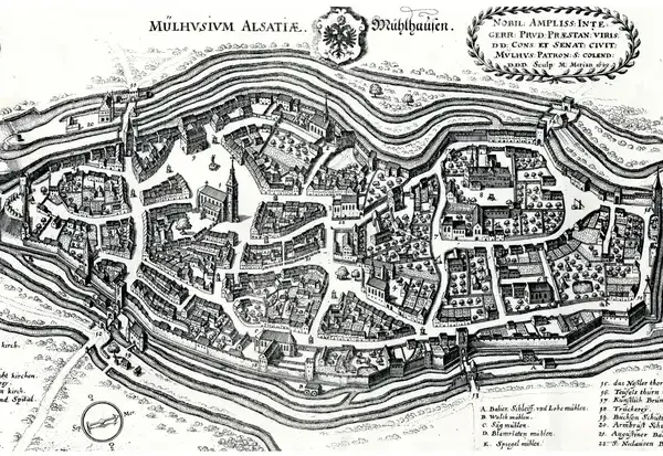
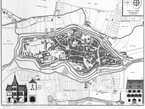
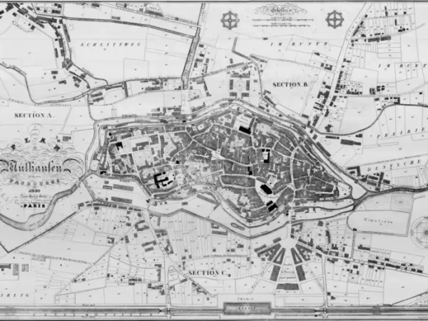
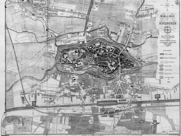
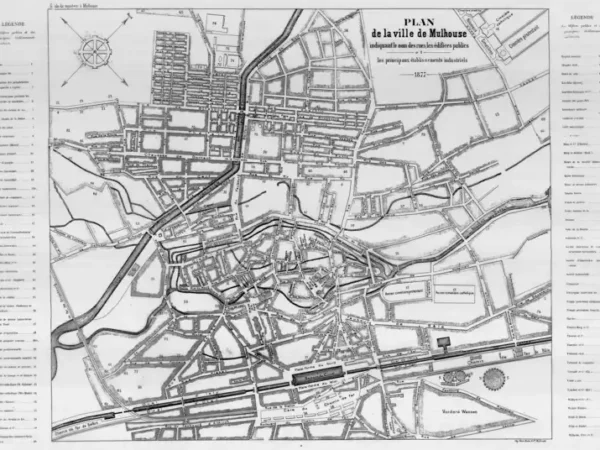
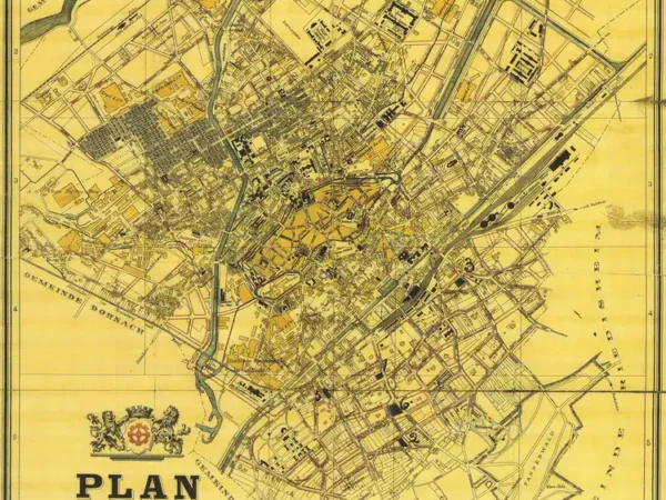
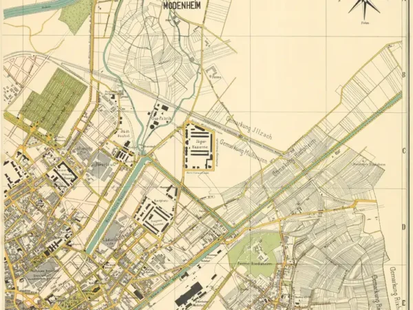
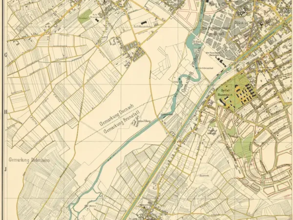
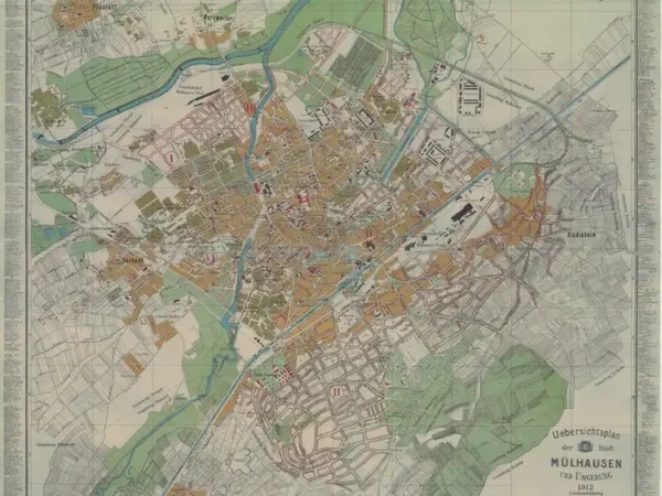
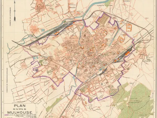
探索描绘米卢斯在1642年至1943年间变迁的历史地图。通过这些地图,您将发现这座城市的城市演变:它最初的防御工事、19世纪的工业扩张,以及两次世界大战带来的动荡。每一张地图都是米卢斯历史的一扇窗户,揭示了其街道、建筑和社区如何在几个世纪中发生变化,见证了其持续的发展。
- 1642
- 1797
- 1830
- 1844
- 1850
- 1860
- 1873
- 1877
- 1886
- 1886
- 1886
- 1896
- 1903
- 1910
- 1911
- 1911
- 1911
- 1911
- 1912
- 1919
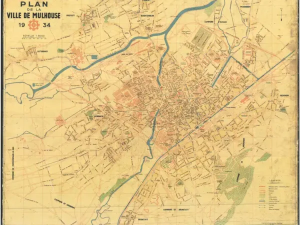
- 1934
- 1943
- 1943
-
Plan of the City of Mulhouse based on the original belonging to the Historical Museum of Mulhouse
Année du plan : 1797
Échelle du plan : 1/2500
Scan to open the map in high resolution, or download it

-
Plan of Mülhausen and its suburbs by Jean-Henri Hofer
Année du plan : 1830
Échelle du plan : 1/20000
Scan to open the map in high resolution, or download it

-
Plan of Mulhouse executed according to the Alignment Plan authorized by royal decree by Charles Edmond, Surveyor, and Engelmann Father & Sons, Lithographic Printers
Année du plan : 1844
Échelle du plan : 1/3300
Scan to open the map in high resolution, or download it

-
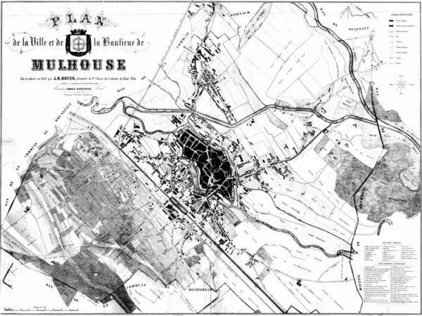
Plan of the City and Suburbs of Mulhouse by J.H. Hofer, Surveyor
Année du plan : 1850
Échelle du plan : 1/5000
Scan to open the map in high resolution, or download it

-
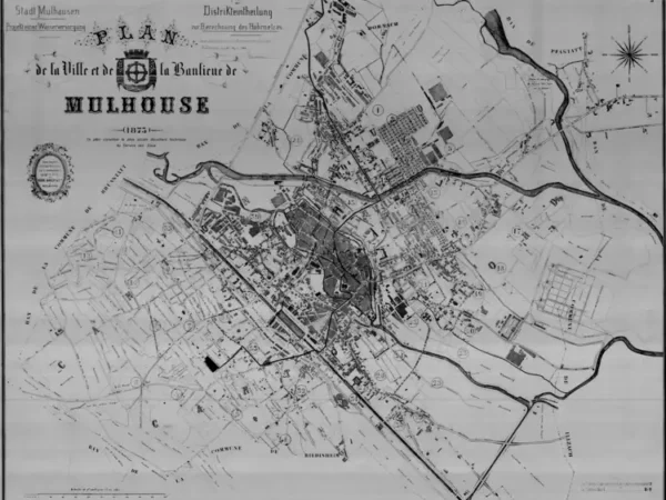
Plan of the City and Suburbs of Mulhouse (the oldest document from the Mulhouse Water Service)
Année du plan : 1873
Échelle du plan : 1/5000
Scan to open the map in high resolution, or download it

-
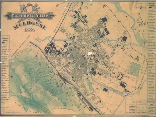
Plan of the City of Mulhouse on cardboard
Année du plan : 1886
Échelle du plan : 1/10000
Scan to open the map in high resolution, or download it

-
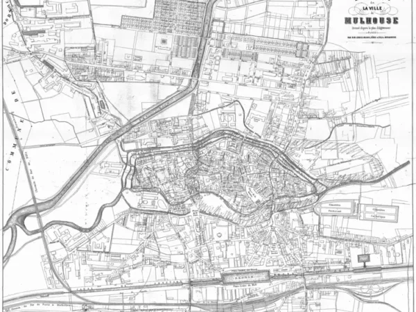
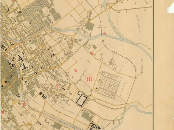
Plan of the City of Mulhouse – North – completed by the Municipal Public Works Department
Année du plan : 1886
Échelle du plan : 1/5000
Scan to open the map in high resolution, or download it

-
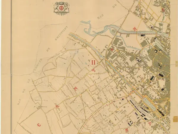
Plan of the City of Mulhouse – South – completed by the Municipal Public Works Department
Année du plan : 1886
Échelle du plan : 1/5000
Scan to open the map in high resolution, or download it

-
Plan of the City of Mülhausen
Année du plan : 1896
Échelle du plan : 1/10000
Scan to open the map in high resolution, or download it

-
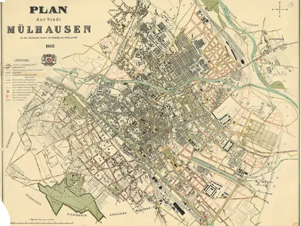
Plan of the City of Mülhausen
Année du plan : 1903
Échelle du plan : 1/5000
Scan to open the map in high resolution, or download it

-
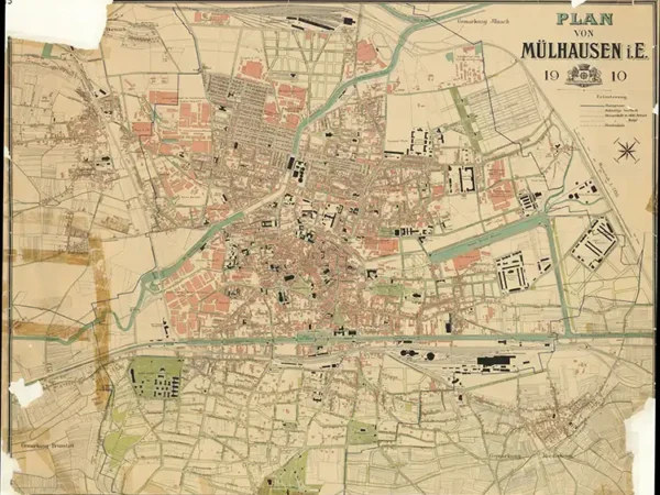
Plan of Mülhausen
Année du plan : 1910
Échelle du plan : 1/5125
Scan to open the map in high resolution, or download it

-
Overview Map of the City of Mülhausen and Surroundings – North-West
Année du plan : 1911
Échelle du plan : 1/4000
Scan to open the map in high resolution, or download it

-
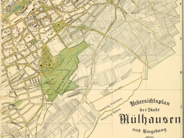
Overview Map of the City of Mülhausen and Surroundings – South-East
Année du plan : 1911
Échelle du plan : 1/4000
Scan to open the map in high resolution, or download it

-
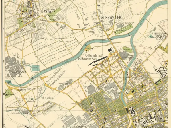
Overview Map of the City of Mülhausen and Surroundings – North-East
Année du plan : 1911
Échelle du plan : 1/4000
Scan to open the map in high resolution, or download it

-
Overview Map of the City of Mülhausen and Surroundings – South-West
Année du plan : 1911
Échelle du plan : 1/4000
Scan to open the map in high resolution, or download it

-
Overview Map of the City of Mülhausen and Surroundings
Année du plan : 1912
Échelle du plan : 1/8000
Scan to open the map in high resolution, or download it

-
Plan of the City of Mulhouse (1919) with the urban limit set by prefectural decree dated 11/22/1924
Année du plan : 1919
Échelle du plan : 1/12500
Scan to open the map in high resolution, or download it

-
Plan of the City of Mulhouse with the tramway network
Année du plan : 1934
Échelle du plan : 1/8000
Scan to open the map in high resolution, or download it

-
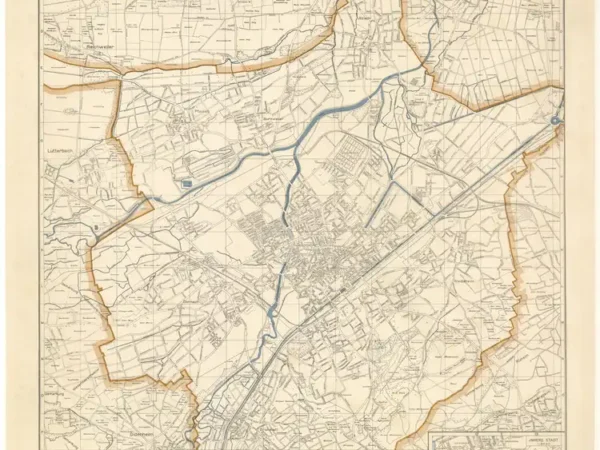
Plan of the City of Mülhausen in Alsace
Année du plan : 1943
Échelle du plan : 1/15000
Scan to open the map in high resolution, or download it

-
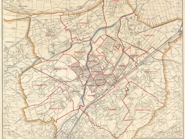
Plan of the City of Mülhausen in Alsace, with neighborhood boundaries
Année du plan : 1943
Échelle du plan : 1/15000
Scan to open the map in high resolution, or download it

