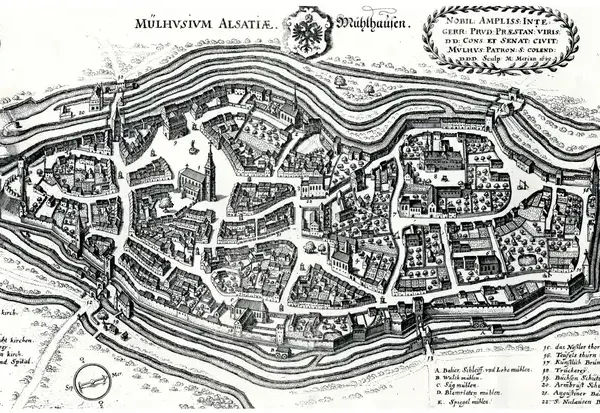
- 1642
- 1797
- 1830
- 1844
- 1850
- 1860
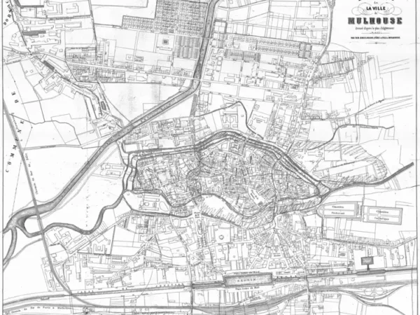
- 1873
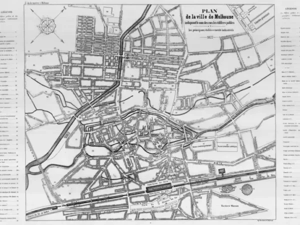
- 1877
- 1886
- 1886
- 1886
- 1896
- 1903
- 1910
- 1911
- 1911
- 1911
- 1911
- 1912
- 1919
- 1934
- 1943
- 1943
-
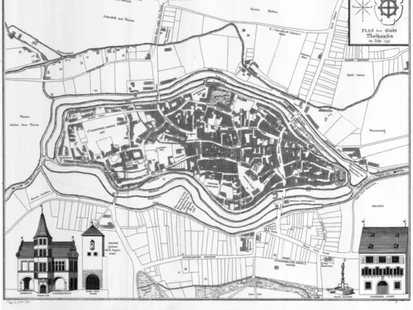
Plan de la Ville de Mulhouse d’après l’original appartenant au Musée Historique de Mulhouse
Année du plan : 1797
Échelle du plan : 1/2500
Scan to open the map in high resolution, or download it

-
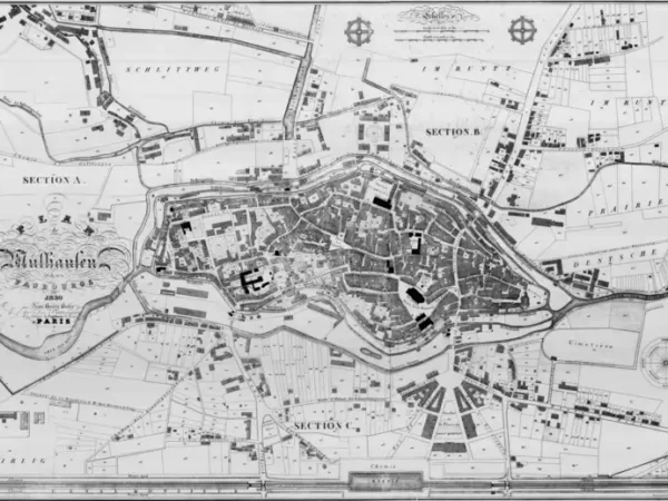
Plan de Mülhausen et de ses faubourgs par Jean-Henri Hofer
Année du plan : 1830
Échelle du plan : 1/20000
Scan to open the map in high resolution, or download it

-
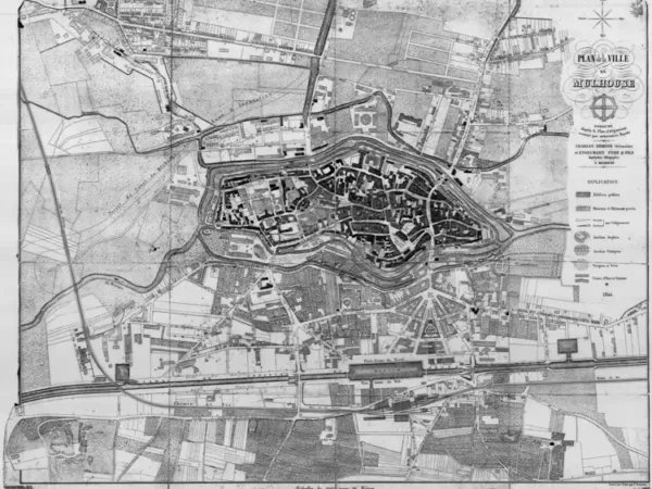
Plan de Mulhouse exécuté d’après le plan d’Alignement autorisé par ordonnance royale par Charles Edmond Géomètre et Engelmann Père&Fils imprimeurs lithographes
Année du plan : 1844
Échelle du plan : 1/3300
Scan to open the map in high resolution, or download it

-
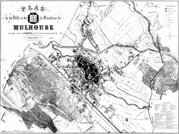
Plan de la Ville et de la Banlieue de Mulhouse par J.H. Hofer Géomètre
Année du plan : 1850
Échelle du plan : 1/5000
Scan to open the map in high resolution, or download it

-
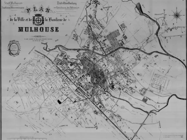
Plan de la Ville et de la banlieue de Mulhouse (le plus ancien document du Service des Eaux de la Ville de Mulhouse)
Année du plan : 1873
Échelle du plan : 1/5000
Scan to open the map in high resolution, or download it

-
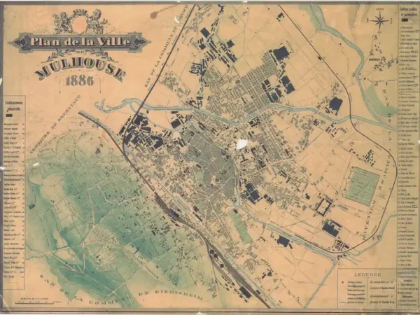
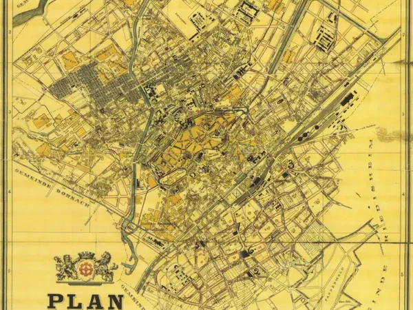
Plan de la Ville de Mulhouse sur carton
Année du plan : 1886
Échelle du plan : 1/10000
Scan to open the map in high resolution, or download it

-
Plan de la Ville de Mulhouse – Nord – complété par le Service municpal des Travaux publics
Année du plan : 1886
Échelle du plan : 1/5000
Scan to open the map in high resolution, or download it

-
Plan de la Ville de Mulhouse – Sud – complété par le Service municpal des Travaux publics
Année du plan : 1886
Échelle du plan : 1/5000
Scan to open the map in high resolution, or download it

-
Plan der Stadt Mülhausen
Année du plan : 1896
Échelle du plan : 1/10000
Scan to open the map in high resolution, or download it

-
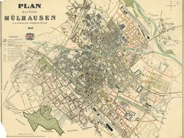
Plan der Stadt Mülhausen
Année du plan : 1903
Échelle du plan : 1/5000
Scan to open the map in high resolution, or download it

-
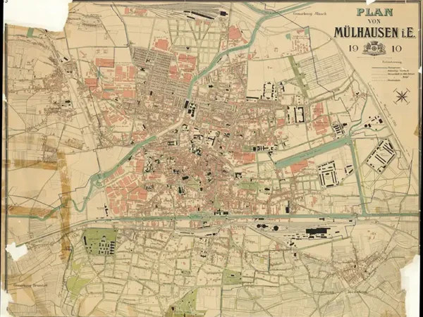
Plan von Mülhausen
Année du plan : 1910
Échelle du plan : 1/5125
Scan to open the map in high resolution, or download it

-
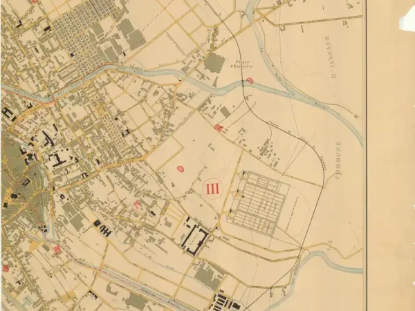
Uebersichtsplan der Stadt Mülhausen und Umgebung – Nord-Ouest
Année du plan : 1911
Échelle du plan : 1/4000
Scan to open the map in high resolution, or download it

-

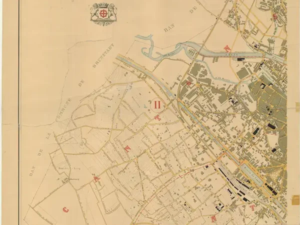
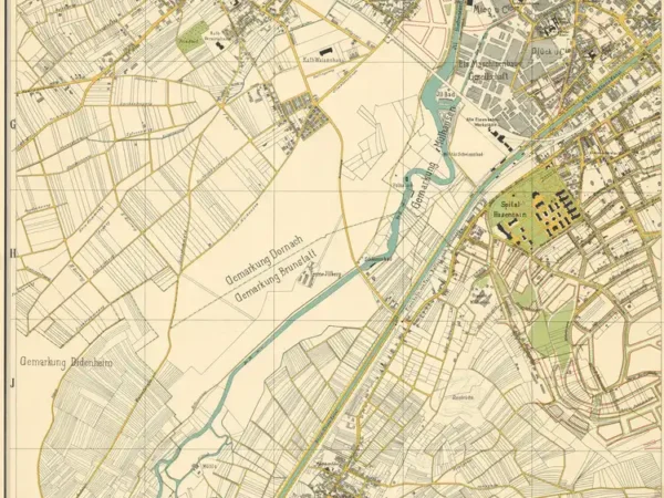
Uebersichtsplan der Stadt Mülhausen und Umgebung – Sud-Est
Année du plan : 1911
Échelle du plan : 1/4000
Scan to open the map in high resolution, or download it

-
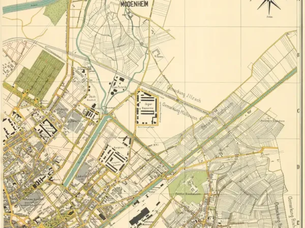
Uebersichtsplan der Stadt Mülhausen und Umgebung – Nord-Est
Année du plan : 1911
Échelle du plan : 1/4000
Scan to open the map in high resolution, or download it

-
Uebersichtsplan der Stadt Mülhausen und Umgebung – Sud-Ouest
Année du plan : 1911
Échelle du plan : 1/4000
Scan to open the map in high resolution, or download it

-
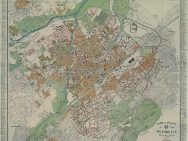
Uebersichtsplan der Stadt Mülhausen und Umgebung
Année du plan : 1912
Échelle du plan : 1/8000
Scan to open the map in high resolution, or download it

-
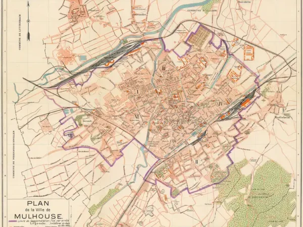
Plan de la Ville de Mulhouse (1919) avec limite de l’agglomération fixé par arrêté préfectoral en date du 22/11/1924
Année du plan : 1919
Échelle du plan : 1/12500
Scan to open the map in high resolution, or download it

-
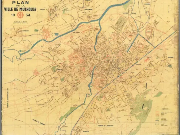
Plan de la Ville de Mulhouse avec réseau de tramway
Année du plan : 1934
Échelle du plan : 1/8000
Scan to open the map in high resolution, or download it

-
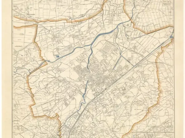
Plan der Stadt Mülhausen im Elsass
Année du plan : 1943
Échelle du plan : 1/15000
Scan to open the map in high resolution, or download it

-
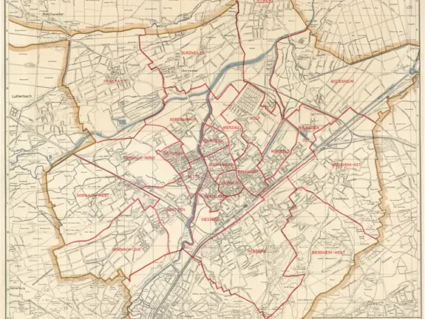
Plan der Stadt Mülhausen im Elsass, avec limites des quartiers
Année du plan : 1943
Échelle du plan : 1/15000
Scan to open the map in high resolution, or download it