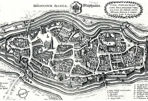
- 1642
- 1797
- 1830
- 1844
- 1850
- 1860
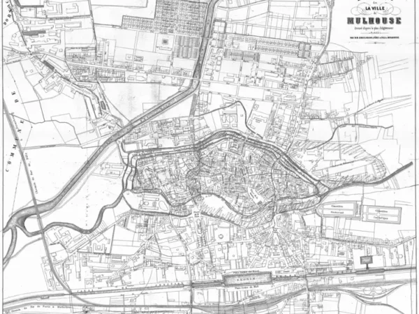
- 1873
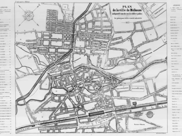
- 1877
- 1886
- 1886
- 1886
- 1896
- 1903
- 1910
- 1911
- 1911
- 1911
- 1911
- 1912
- 1919
- 1934
- 1943
- 1943
-
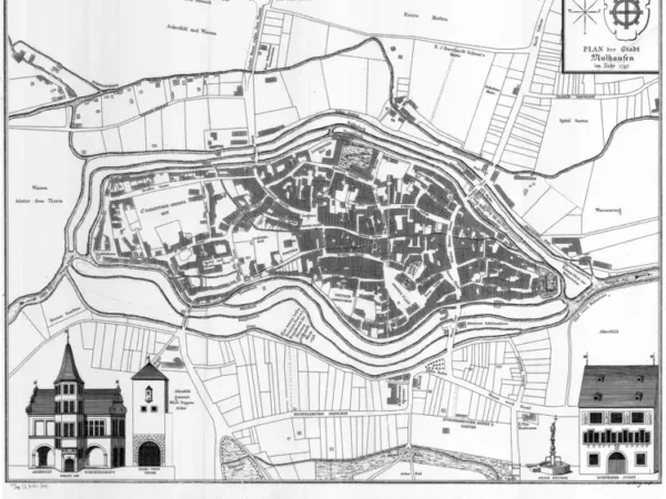
Plan of the City of Mulhouse based on the original belonging to the Historical Museum of Mulhouse
Année du plan : 1797
Échelle du plan : 1/2500
Scan to open the map in high resolution, or download it

-
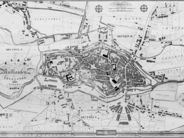
Plan of Mülhausen and its suburbs by Jean-Henri Hofer
Année du plan : 1830
Échelle du plan : 1/20000
Scan to open the map in high resolution, or download it

-
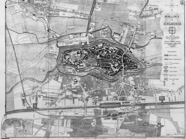
Plan of Mulhouse executed according to the Alignment Plan authorized by royal decree by Charles Edmond, Surveyor, and Engelmann Father & Sons, Lithographic Printers
Année du plan : 1844
Échelle du plan : 1/3300
Scan to open the map in high resolution, or download it

-
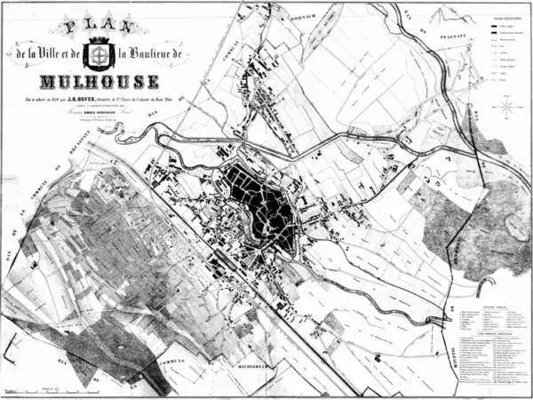
Plan of the City and Suburbs of Mulhouse by J.H. Hofer, Surveyor
Année du plan : 1850
Échelle du plan : 1/5000
Scan to open the map in high resolution, or download it

-
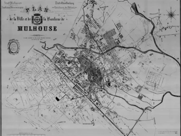
Plan of the City and Suburbs of Mulhouse (the oldest document from the Mulhouse Water Service)
Année du plan : 1873
Échelle du plan : 1/5000
Scan to open the map in high resolution, or download it

-
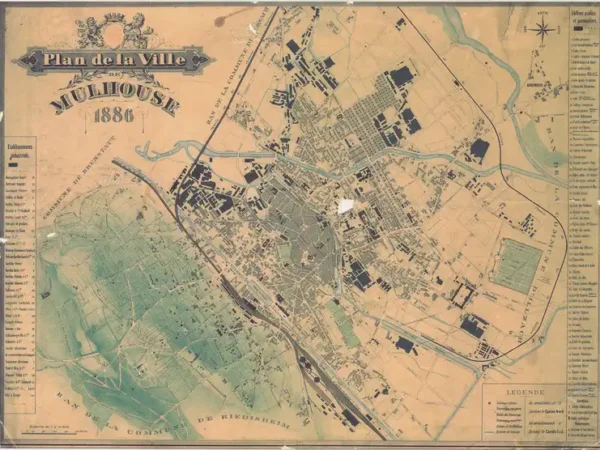
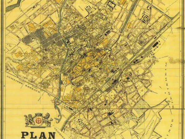
Plan of the City of Mulhouse on cardboard
Année du plan : 1886
Échelle du plan : 1/10000
Scan to open the map in high resolution, or download it

-
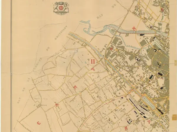
Plan of the City of Mulhouse – North – completed by the Municipal Public Works Department
Année du plan : 1886
Échelle du plan : 1/5000
Scan to open the map in high resolution, or download it

-
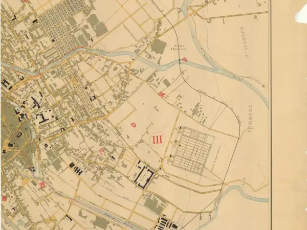
Plan of the City of Mulhouse – South – completed by the Municipal Public Works Department
Année du plan : 1886
Échelle du plan : 1/5000
Scan to open the map in high resolution, or download it

-
Plan of the City of Mülhausen
Année du plan : 1896
Échelle du plan : 1/10000
Scan to open the map in high resolution, or download it

-
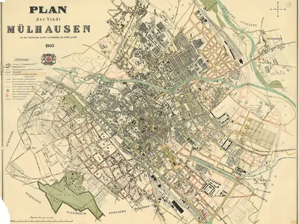
Plan of the City of Mülhausen
Année du plan : 1903
Échelle du plan : 1/5000
Scan to open the map in high resolution, or download it

-
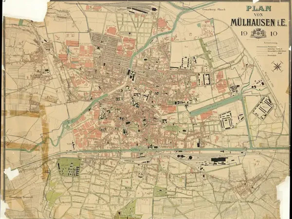
Plan of Mülhausen
Année du plan : 1910
Échelle du plan : 1/5125
Scan to open the map in high resolution, or download it

-
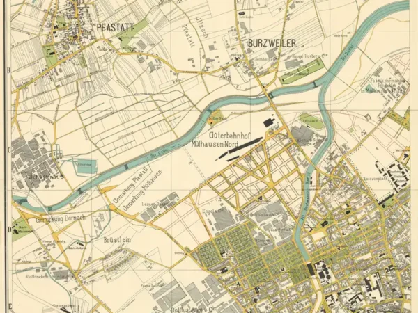
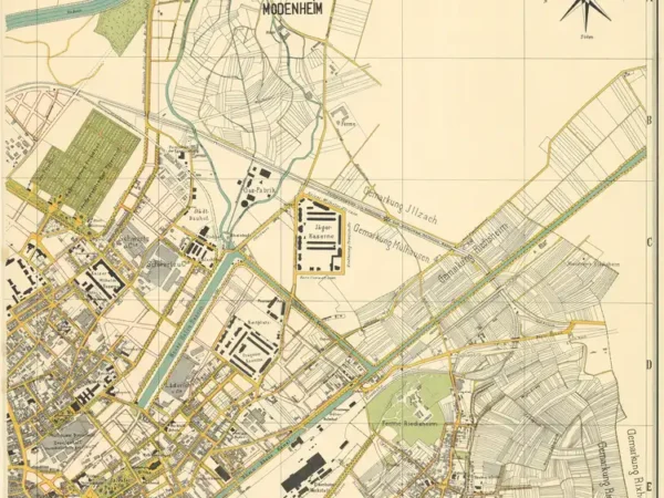
Overview Map of the City of Mülhausen and Surroundings – North-West
Année du plan : 1911
Échelle du plan : 1/4000
Scan to open the map in high resolution, or download it

-

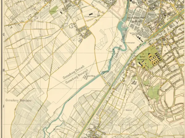
Overview Map of the City of Mülhausen and Surroundings – South-East
Année du plan : 1911
Échelle du plan : 1/4000
Scan to open the map in high resolution, or download it

-
Overview Map of the City of Mülhausen and Surroundings – North-East
Année du plan : 1911
Échelle du plan : 1/4000
Scan to open the map in high resolution, or download it

-
Overview Map of the City of Mülhausen and Surroundings – South-West
Année du plan : 1911
Échelle du plan : 1/4000
Scan to open the map in high resolution, or download it

-
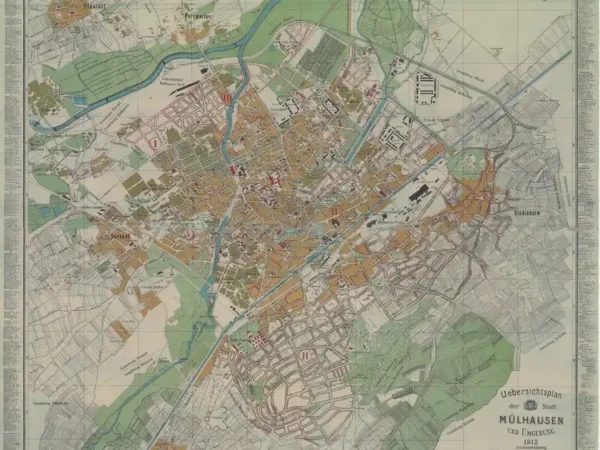
Overview Map of the City of Mülhausen and Surroundings
Année du plan : 1912
Échelle du plan : 1/8000
Scan to open the map in high resolution, or download it

-
Plan of the City of Mulhouse (1919) with the urban limit set by prefectural decree dated 11/22/1924
Année du plan : 1919
Échelle du plan : 1/12500
Scan to open the map in high resolution, or download it

-
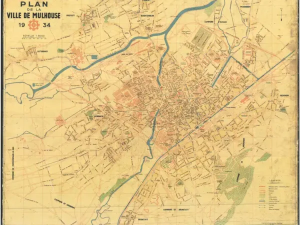
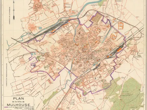
Plan of the City of Mulhouse with the tramway network
Année du plan : 1934
Échelle du plan : 1/8000
Scan to open the map in high resolution, or download it

-
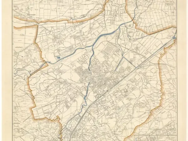
Plan of the City of Mülhausen in Alsace
Année du plan : 1943
Échelle du plan : 1/15000
Scan to open the map in high resolution, or download it

-
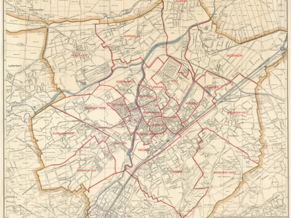
Plan of the City of Mülhausen in Alsace, with neighborhood boundaries
Année du plan : 1943
Échelle du plan : 1/15000
Scan to open the map in high resolution, or download it