Mulhouse, Zeuge der Jahrhunderte
Vom keltischen Ursprung zur modernen Stadt: eine Stadt in ständigem Wandel
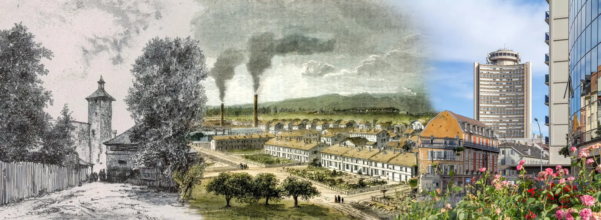
Entdecken Sie die faszinierende Geschichte von Mulhouse, die sich durch die Zeiten zieht, von ihren keltischen Ursprüngen im Jahr 1000 v. Chr. bis zu ihrer bedeutenden industriellen Rolle und den jüngsten ökologischen Umwandlungen im Jahr 2024. Jede Epoche hat ihre Spuren hinterlassen. Heute erfindet sich Mulhouse, getragen von einer vielfältigen und engagierten Bevölkerung, ständig neu. Sie verkörpert das perfekte Gleichgewicht zwischen Tradition und Innovation, wo jeder Stein und jede Straße von einer reichen Vergangenheit, einer dynamischen Gegenwart und einer vielversprechenden Zukunft zeugen.
Quellen
Wikipedia - Aéroport international de Bâle-Mulhouse - Mapcarta - Bourtzwille - https://fr.wikipedia.org/wiki/Tramway_de_Mulhouse - Wikipedia - Tram-train Mulhouse Vallée de la Thur - Wikipedia - TGV Rhin-Rhône - FACS - Tram-train et tramways de Mulhouse - m2A - Mulhouse Alsace Agglomération - Tram-train - Wikipedia - Mulhouse Tramway (version allemande) - Le Livre Scolaire - French Moments - Mulhouse History - HAL Archives Ouvertes - Mulhouse and its History - Structurae - Gare de Mulhouse Ville - Histoires et Lieux d'Alsace - VHC magazine - Extrait de L’Histoire de Mulhouse en 111 dates
Die historischen Pläne von Mulhouse
Kartographische Entwicklung der Stadt von 1642 bis 1943
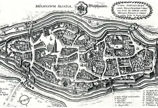
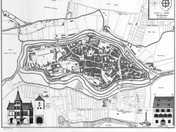
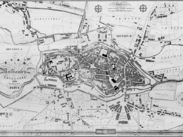
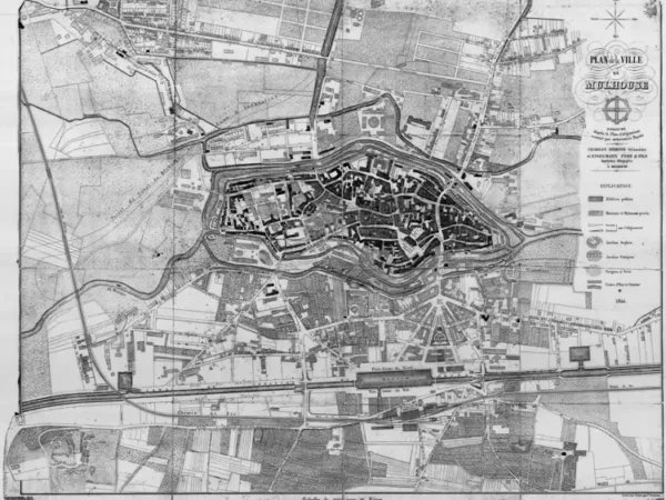
Entdecken Sie die historischen Pläne, die die Veränderungen von Mulhouse zwischen 1642 und 1943 nachzeichnen. Durch diese Karten entdecken Sie die städtische Entwicklung der Stadt: ihre ersten Befestigungen, die industriellen Expansionen des 19. Jahrhunderts und die Umwälzungen im Zusammenhang mit den beiden Weltkriegen. Jeder Plan ist ein Fenster in die Geschichte von Mulhouse und zeigt, wie sich seine Straßen, Gebäude und Stadtteile im Laufe der Jahrhunderte verändert haben und von seiner stetigen Entwicklung zeugen.
- 1642
- 1797
- 1830
- 1844
- 1850
- 1860
- 1873
- 1877
- 1886
- 1886
- 1886
- 1896
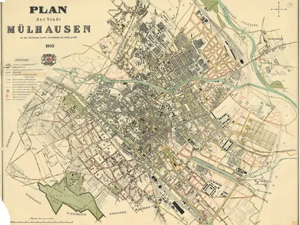
- 1903
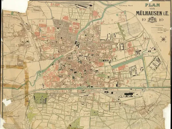
- 1910
- 1911
- 1911
- 1911
- 1911
- 1912
- 1919
- 1934
- 1943
- 1943
-
Plan of the City of Mulhouse based on the original belonging to the Historical Museum of Mulhouse
Année du plan : 1797
Échelle du plan : 1/2500
Scan to open the map in high resolution, or download it

-
Plan of Mülhausen and its suburbs by Jean-Henri Hofer
Année du plan : 1830
Échelle du plan : 1/20000
Scan to open the map in high resolution, or download it

-
Plan of Mulhouse executed according to the Alignment Plan authorized by royal decree by Charles Edmond, Surveyor, and Engelmann Father & Sons, Lithographic Printers
Année du plan : 1844
Échelle du plan : 1/3300
Scan to open the map in high resolution, or download it

-
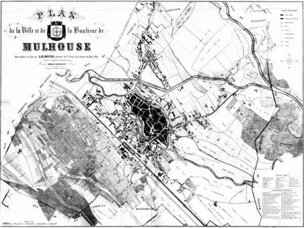
Plan of the City and Suburbs of Mulhouse by J.H. Hofer, Surveyor
Année du plan : 1850
Échelle du plan : 1/5000
Scan to open the map in high resolution, or download it

-
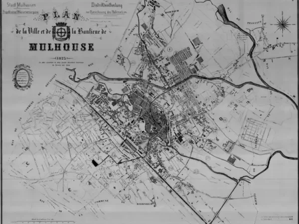
Plan of the City and Suburbs of Mulhouse (the oldest document from the Mulhouse Water Service)
Année du plan : 1873
Échelle du plan : 1/5000
Scan to open the map in high resolution, or download it

-
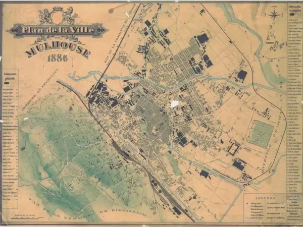
Plan of the City of Mulhouse on cardboard
Année du plan : 1886
Échelle du plan : 1/10000
Scan to open the map in high resolution, or download it

-
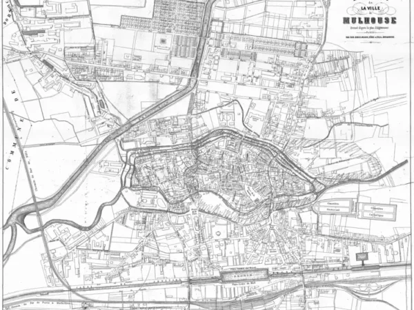
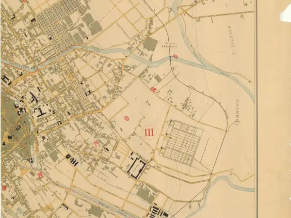
Plan of the City of Mulhouse – North – completed by the Municipal Public Works Department
Année du plan : 1886
Échelle du plan : 1/5000
Scan to open the map in high resolution, or download it

-
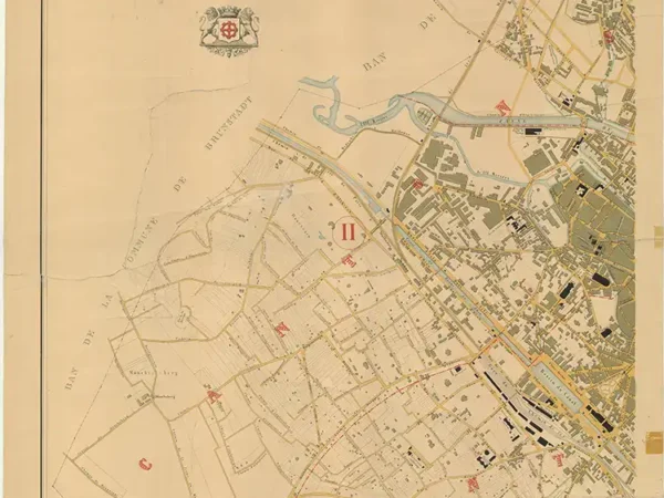
Plan of the City of Mulhouse – South – completed by the Municipal Public Works Department
Année du plan : 1886
Échelle du plan : 1/5000
Scan to open the map in high resolution, or download it

-
Plan of the City of Mülhausen
Année du plan : 1896
Échelle du plan : 1/10000
Scan to open the map in high resolution, or download it

-
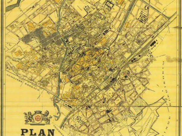
Plan of the City of Mülhausen
Année du plan : 1903
Échelle du plan : 1/5000
Scan to open the map in high resolution, or download it

-
Plan of Mülhausen
Année du plan : 1910
Échelle du plan : 1/5125
Scan to open the map in high resolution, or download it

-
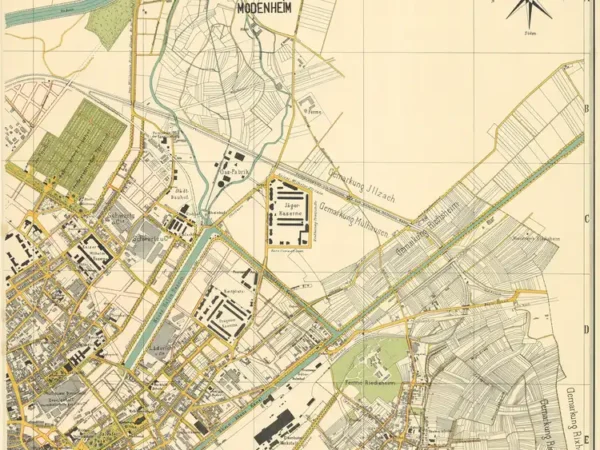
Overview Map of the City of Mülhausen and Surroundings – North-West
Année du plan : 1911
Échelle du plan : 1/4000
Scan to open the map in high resolution, or download it

-
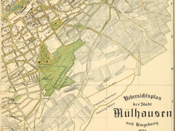
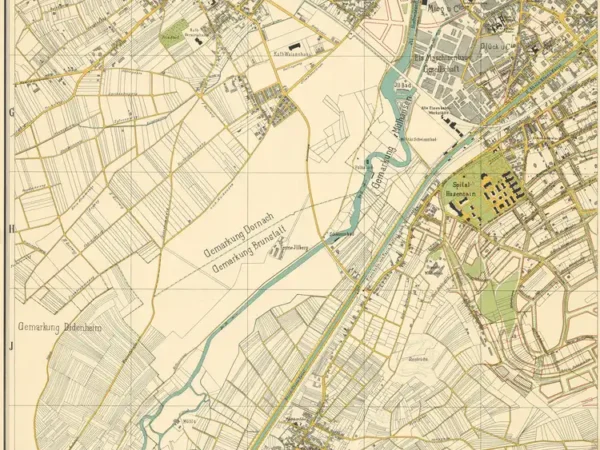
Overview Map of the City of Mülhausen and Surroundings – South-East
Année du plan : 1911
Échelle du plan : 1/4000
Scan to open the map in high resolution, or download it

-
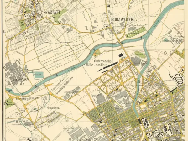
Overview Map of the City of Mülhausen and Surroundings – North-East
Année du plan : 1911
Échelle du plan : 1/4000
Scan to open the map in high resolution, or download it

-
Overview Map of the City of Mülhausen and Surroundings – South-West
Année du plan : 1911
Échelle du plan : 1/4000
Scan to open the map in high resolution, or download it

-
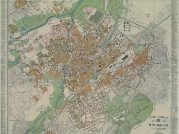
Overview Map of the City of Mülhausen and Surroundings
Année du plan : 1912
Échelle du plan : 1/8000
Scan to open the map in high resolution, or download it

-
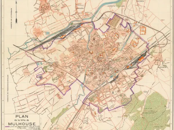
Plan of the City of Mulhouse (1919) with the urban limit set by prefectural decree dated 11/22/1924
Année du plan : 1919
Échelle du plan : 1/12500
Scan to open the map in high resolution, or download it

-
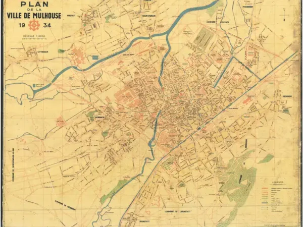
Plan of the City of Mulhouse with the tramway network
Année du plan : 1934
Échelle du plan : 1/8000
Scan to open the map in high resolution, or download it

-
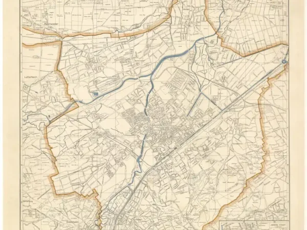
Plan of the City of Mülhausen in Alsace
Année du plan : 1943
Échelle du plan : 1/15000
Scan to open the map in high resolution, or download it

-
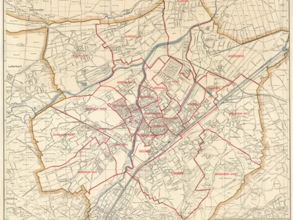
Plan of the City of Mülhausen in Alsace, with neighborhood boundaries
Année du plan : 1943
Échelle du plan : 1/15000
Scan to open the map in high resolution, or download it

